We are recruiting for the 2013 season in Jordan and have a few places remaining. For full details of the dig this year please see the 2013 Prospectus
Wednesday, 10 April 2013
Sunday, 27 November 2011
Day 13,14 - Siddons Ridge Camp and summing up
So - we finished up at Siddon's Ridge yesterday with all the team working hard to complete the tasks they had started previously. Final searches, excavations, cleaning, drawing, measuring and planning all taking place to achieve as much as we could at the end of this amazing season.


Then back to the hotel on the last dark, dusty drive from site through the desert. Once cleaned up and having eaten we had a 'show and tell' session displaying some of the important finds of the season to the entire group, with lively questions and answers given as best they could be. This was followed by an overview of the project's inception and development, and a discussion of how what we had achieved fits in with the huge amount of other information we have already discovered. We then watched a copy of the programme made by National Geographic who spent some time with us last season and entitled "The Mystery Files - Lawrence of Arabia". A late but very enjoyable evening to round up the work of the season.
So - what next?


Several reconnaissance trips were made by a small team in order to assess possibilities for research in future years. The first was to the area of Mudowarra, south of Ma’an, near the present-day border with Saudi Arabia. Here, three large and heavily-fortified hill-tops were located, whose summits were surrounded by extensive dry-stone walls with numerous loopholes. These places were identified by RFC pilots in advance of, and attacked during, the famous raid by the Imperial Camel Corps on 9 August 1918, which took all three Ottoman positions. The area today is the location of a major Bedouin settlement, where the inhabitants occupy the traditional long tent and also newly-built structures. Only a few hundred metres from the fortified hills is a partly-destroyed Hajj fort which had seen some re-occupation by the Jordanian army in recent decades. The trip concluded with an assessment of the remaining Hejaz Railway buildings – two of which are today occupied by Bedouin families, one of which invited the team to share chai – interestingly in their long tent rather than the station building.


The second trip went north from Ma’an to
the isolated Hejaz Railway station of Suwaqa, where there is a two-storey
station building with two outlying defensive positions on the eastern hills.
The building is well-preserved, with an associated, and now largely destroyed, set
of mud-brick buildings – perhaps a small pre-railway village or maybe structures
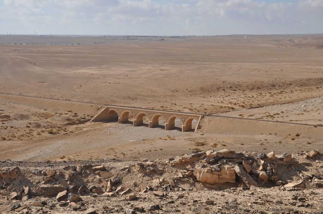
for railway workers or Ottoman troops. Several hundred metres to the southeast is
the best-preserved of the outlying defences – a largely ruined bunker with a
trench running eastwards, and overlooking a multi-span railway bridge to the
west. After leaving Suwaqa the team spent some time examining the very-well
preserved Hejaz station located in the centre of the town of Qatrana. The main
station building is in excellent condition and was inhabited until recently.
The railway is still used to an extent, and there were many rail-trucks in
situ, as well as a triangular ‘passing track’ to allow trains to be manoeuvred
in and out of the station.
All these offer more opportunities to expand our investigations and understanding of this fantastic country and the way in which it's landscape, people and military authorities intertwined and were developed and shaped before, during and since the Great Arab Revolt. We will be back again next year, we hope, to continue this amazing project. Many thanks to all who have followed this blog, passed comments by word of mouth, email, text message, facebook, twitter and all other means. We hope you have enjoyed this portion of our unfolding story and that you will be back next season to discover, with us, what the next phase of this exciting project reveals.
Friday, 25 November 2011
Day 12 - Second day at Siddon's Ridge Camp
Back to the ridge site which is has a wide variety of features spread across the top of the site, and on lower lying land at each end. These include several sets of tent rings, some large hollowed out firing positions connected by what might be a snaking communications trench, gun emplacements, possible latrines and other as yet unidentified constructions in the landscape.
The first pictures shows a view along a part of one line of tent rings towards the north, where a large circular structure which has obvious stone side walls commands a view from the ridge on three sides. Some of the team excavating this feature are shown in the following images, together with a view back along the line looking south.


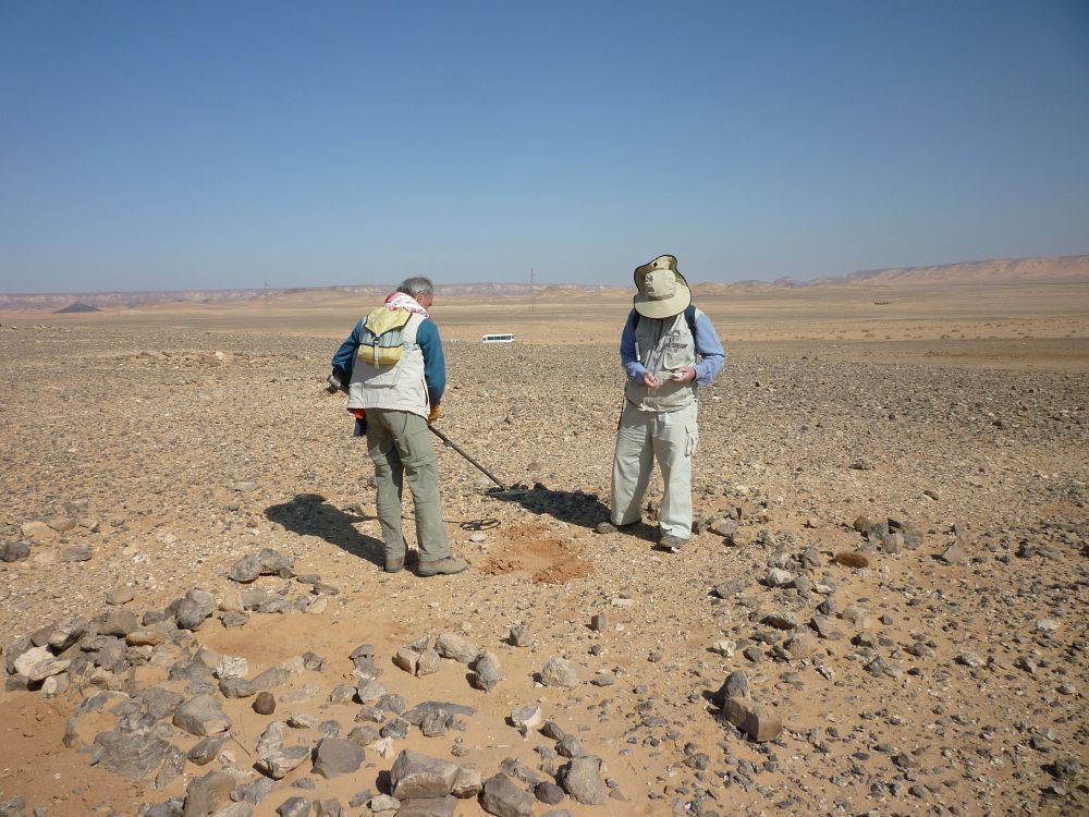
The following image shows a section of the trench we think was for communication and an exploratory sondage dug across it in the near view, with one of our detectorists investigating the forward edge of the trench outer wall. You can see that the trench itself is full of blown sand, which has to be removed to discover the original depth when used.

Another view of one of the large redoubts at one end of the complex.

Before lunch today the whole team took a guided walk from one end of the site to the other, with the members responsible for excavating or examining each feature describing what they were doing and what had been discovered. We also discussed how each feature fitted in with the overall pattern of the site.


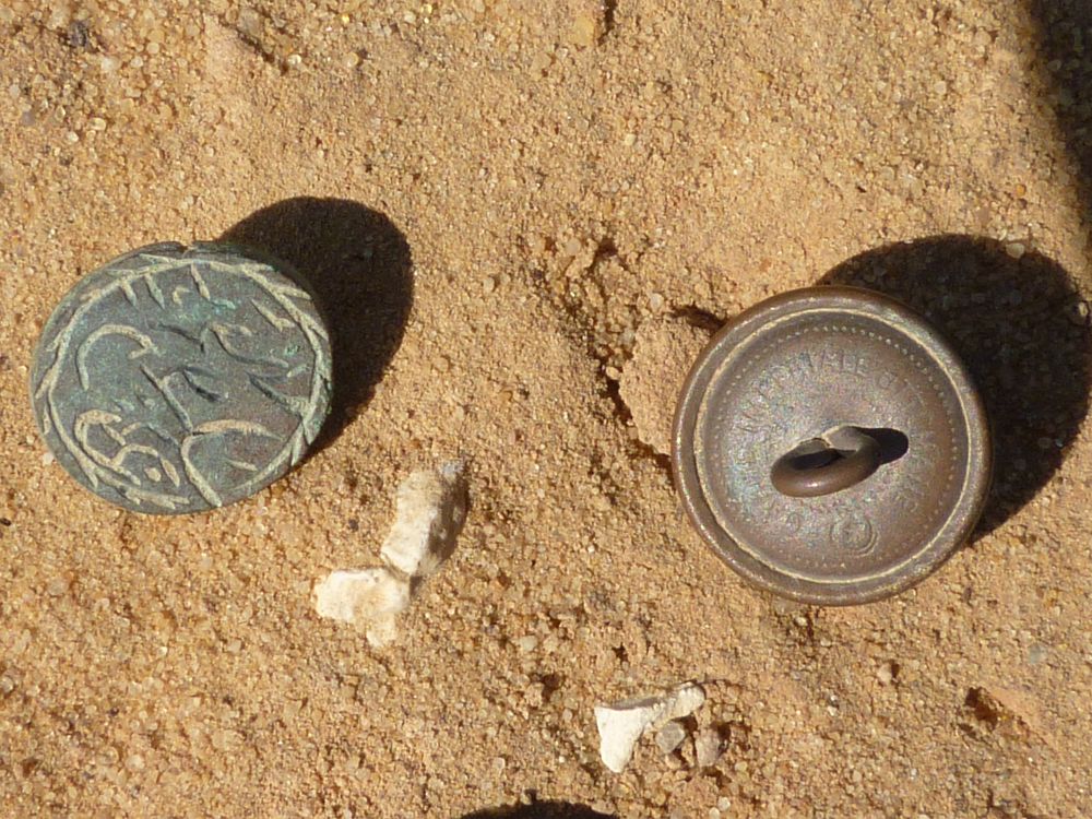
Scattered Mauser cartridges in the south facing wall of a firing position in the southern redoubt. It seems likely that one man fired these at some point when under attack.


A fantastic day on an incredibly interesting site. We return here tomorrow for our final day in the field this season. More pictures, description and theories tomorrow.
Thursday, 24 November 2011
Day 11 – Previous GARP season’s sites visit day
Today by way of a form of late orientation the
bulk of the team travelled to several of the sites previously visited by us
over the past five seasons. The main reason for this was to provide a more
complete overview of the range of sites themselves, their size, main features,
distribution and location in the landscape and in relation to the Hijaz
railway.
On the way today –
disaster. Nearside front blowout on the bus! Fortunately the skilful driver
managed to control the bus neatly to a safe stop. The spare retrieved but no
use – slow puncture in that!

Some swift rearranging of the good wheels and
tyres meant a slow careful drive of the empty bus back to Ma’an, and a two hour
wait in the desert for the occupants. Undeterred they spent the time chatting
and examining their location and it wasn’t long before they were back on the
bus, all wheels now with good tyres.


They began by visiting Batn Al Ghul – the camp
on the plateau above the 100m drop down the escarpment into the southern
desert. This is the place where the landscape breaks from flat basalt land into
the more spectacular red and pink sandy hills which are like those at Wadi Rum.
From there they hiked up the rocky outcrop to the top of Fassuah Ridge – the fort
complex which has the stunning commanding view down into the valley – into Batn
Al Ghul itself. The belly of the beast. The Phosphate trains snake their way
round and eventually down and on to Aqaba where their contents are loaded onto
ships for distribution.


Then back in the transport and down to Wadi
Rutm – a location of a tented camp site a few hundred metres from a battered
station, itself very close to an ancient stopping place which had been used for
millennia for the same purpose by traders and pilgrims. This site was where we
observed the Bedouin camped after dropping down the escarpment in a huge train
of people, camels, other animals and vehicles a few seasons ago, and when we
explored it the next day we indeed found evidence of use there over many
hundreds of years.


The landscape down here is magical and once
seen, never forgotten. Whenever we return to Jordan
Wednesday, 23 November 2011
Day 10 - Siddons Ridge Fort
In January 1918 Captain V.D. Siddons, a member of X Flight of the Royal Flying Corps, flew over a region of desert to the north of Tel El Shahm. Siddons is recorded as acting as Lawrence's pilot at some point during the period. When he returned to base he made a sketch map, from memory, of a fortified position in the region. This map was discovered by one of our team in the National Archive in 2008, and subsequently he visited the area to try to find the site itself.

Today the team went down to the very site in the sketch map drawn by Reverend Siddons. This huge site, with redoubts, trenches, gun emplacements and other features appears to be set in a location that has been occupied in one way or other for centuries, if not millenia. It is also the subject of a descriptive passage in Seven Pillars of Wisdom, which will be included in a later blog - we will be at the site for three days in total.


Work began today investigating some of the main features. At the same time the detectorists swept the slope in front of the ridge and one of the redoubts for evidence of conflict. The preliminary work uncovered several interesting finds but we need to go back again to gather more information before we can make any real sense of the site. One of the difficulties is that the re-use of the site over time has meant that several layers of historical evidence are apparent in some areas. Work will continue on Friday and Saturday here and the blog will be updated as we gather insight.

Today we also have another in our series of reflections on the project by one of this year's members. This is what Zheng Xu thinks about her experience of being with us so far:
"Being a first time volunteer participating in GARP, I did not know what to expect besides the legendary story of T. E . Lawrence
Now we have past the half way point of this journey, after days of hard physical work, my clothing and any exposed surface of my body being covered by sand, numeral "comfort breaks" in any facilities mother nature has to offer, daily lunch of pita bread and hummus and sweet dates, and the mid morning tea breaks to which we all look forward, I have to say this is an unique experience of one's lifetime.
It is unique in the archaeological objectives of GARP. I am honored to be part of a trailblazing project that is unearthing the evidences of an important part of the modern history that shaped the current landscape of the Middle East . In the current political context, it makes one reflect more on the implications of modern conflicts and war fare.
It is unique in the setting where our work takes place. Our physical work each day is being rewarded by the wondrous beauty of the Southern Jordanian desert with its shadows and forms dancing in constantly changing light, prehistoric villages and roadside Roman forts, and the silhouette of a line of camels wandering through the desert at dusk...
It is unique in the multinational team that is comprised of experts and volunteers of all age groups with a range of interests, knowledge, skills and kindness towards each other and sensitivity towards the land, people and the work.
To me, the meaning of this journey will continue to unfold in the days and years to come."
Tomorrow the main group will be on a quick tour of some of the other previously investigated sites that we have looked at over the past 5 seasons, which will enable them to 'fill in the blanks' of the work on the project that has been undertaken so far.
Tuesday, 22 November 2011
Day 9 - Ornamental forts completed and planned
Today we went back to the two ornamental forts to complete their excavation and planning. Many of the team members were involved in this important exercise. Originally we were aware of three of these forts, but already one has been destroyed beyond recognition, and we believe this was done very recently, perhaps even during the last week. For this reason it is vital that we obtain as much information from these features while we can. We have no idea how long they may remain in their present state and identifiably so within the landscape.


By virtue of their position, scale and proximity to each other it seems possible that these ornamental forts, together with other features in the landscape such as block houses and other fortifications, form an intervisible sequence of structures ideally positioned to act as communication links. Our previous excavations have uncovered the metal tapered tips of what might have been a heliograph tripod, which would substantiate the idea that these were used to flash signals up and down the line of the Hijaz.
An absolutely essential part of the recording of all our activities is the completion of a photographic record. Covering everything from general shots of the features themselves and their place within the landscape, to systematic recording of all excavations and also all finds themselves, this process produces a vital, unique archive of visual record of the project.
 |
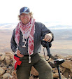
| Ali, our official photographer, at work |
 |
| First battalion RGMDC together with two wannabees. (Royal GARP metal Detecting Corps) |
On a lighter note, last season's Goofer Rifles are now joined in their pursuit of GARP related desert activities by the MD Corps, here presenting their arms with two keen team members anxious to become a part of this august group.
Subscribe to:
Posts (Atom)